
Viking Route To North America
 I was reading a book called, “God’s Blueprint,” by Christopher Knight. This book is about how the earth was made for man. While this author talked a lot about what we disagree with, some of which is the age of the earth and the heliocentric model of the Universe, there was a very interesting and revealing part that Knight wrote about but did not realise the implications of.
On page 50-52, Knight talked about his phone conversation with Fred Olson, a Norwegian shipping magnet. Olson said that the Vikings made Bristol, England their jumping off point to North America. This was was before Christopher Columbus, of course. Fred Olson said that there are old archives in Bristol that tell of where the Viking sailed. He said that the Vikings never lost sight of land when they sailed to North America and he listed the islands that they sailed passed when traveling from England to North America. They were:
Bristol
Hebrides
Orkney
North Ronaldsay
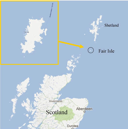
Fair Isle
Shetland
Then from Shetland it was 150 miles to Faroe Islands
Then the long stretch to Iceland 240 miles
Then 150 miles to Greenland
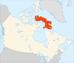
Finally, 180 miles to Baffin Island in North America
What not mentioned in the book was that the Vikings sailed NORTH and not directly across the Atlantic as one would expect.
Now critics might argue, “How can you see land if something is 240 miles away?” Good question but I thought of this. Just because the distance is 240 miles (maximum mentioned), that doesn’t mean that land was 240 miles away. The 240 miles is the distance between Iceland and Greenland. When you sail away, one land mass is receding and the other is coming into view.
The distance that you can see depends on several variables. They are:
how clear the atmosphere is
how high you are above sea level
how good that person’s vision is
Thinking back to 1,000A.D., the air would be very clean. The explorer would be up a mast and he might have had good vision, too. So, you are looking at – in this example – one half of 240 miles, which would be 120 miles. If you recall, if you have read Posts on this website, there is a record of a man seeing a ship at sea that was 200 miles away. This was back in the 1800s I believe. So, seeing land while between Iceland and Greenland is quite possible.
Another thing to consider is, that the Viking went North and West, not directly West, as one would expect. You can be sure that all ships today traveling from Europe to North America travels a north-westerly route, too.
When you think about it, if you lived a millennia or two ago, why would you travel far out to sea not know if and when you will reach land. You would naturally want to keep land in sight and this is what the Vikings did. This was their assurance that if something happened to their ship they could head to land. I believe that God arranged the land masses the way he did with a purpose; that all of creation has a purpose and that includes the layout of the continents.
Ships and planes would travel the same route, in the above example, by following the land mass as much as they can. In this case, it would be (going from the UK to North America) in a north-westerly direction. I don’t recall if a pilot tells the passengers of the land masses or countries they are near. Maybe you may recall if they tell the truth and that they are flying North, when everyone would expect to be flying directly West.
